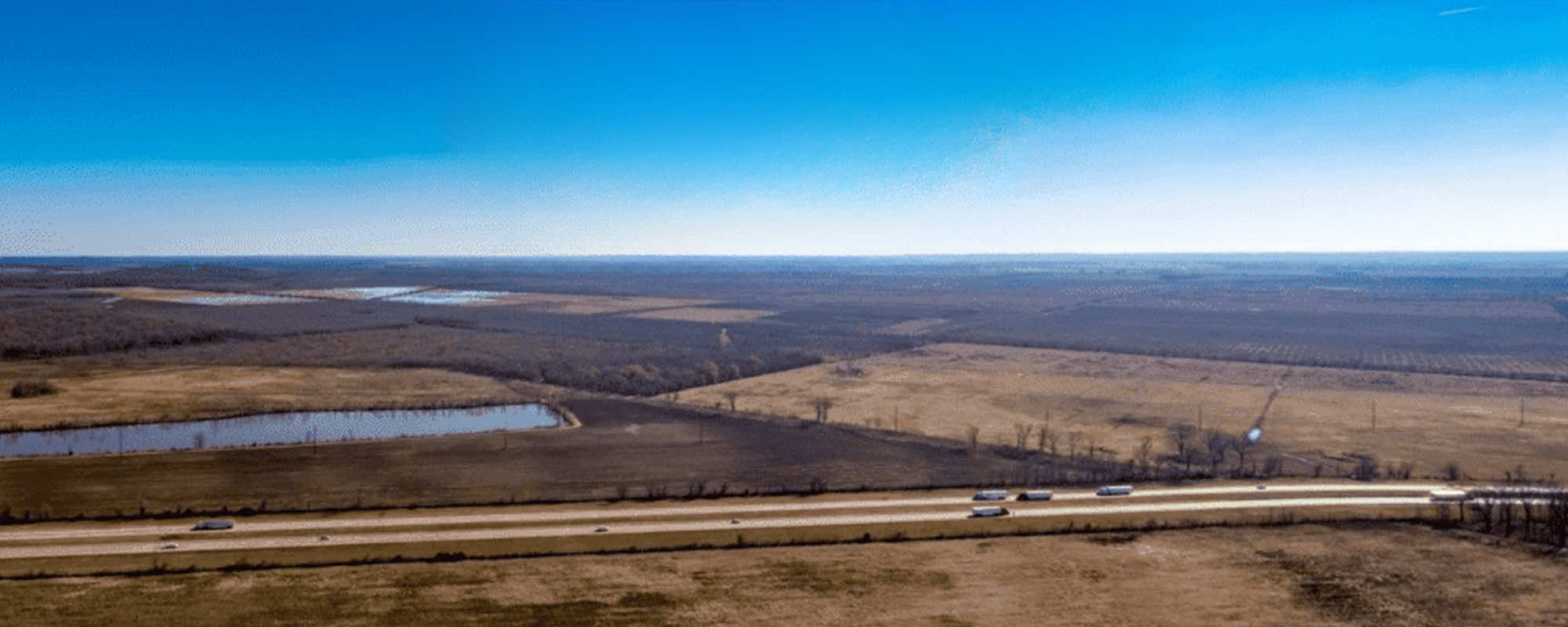
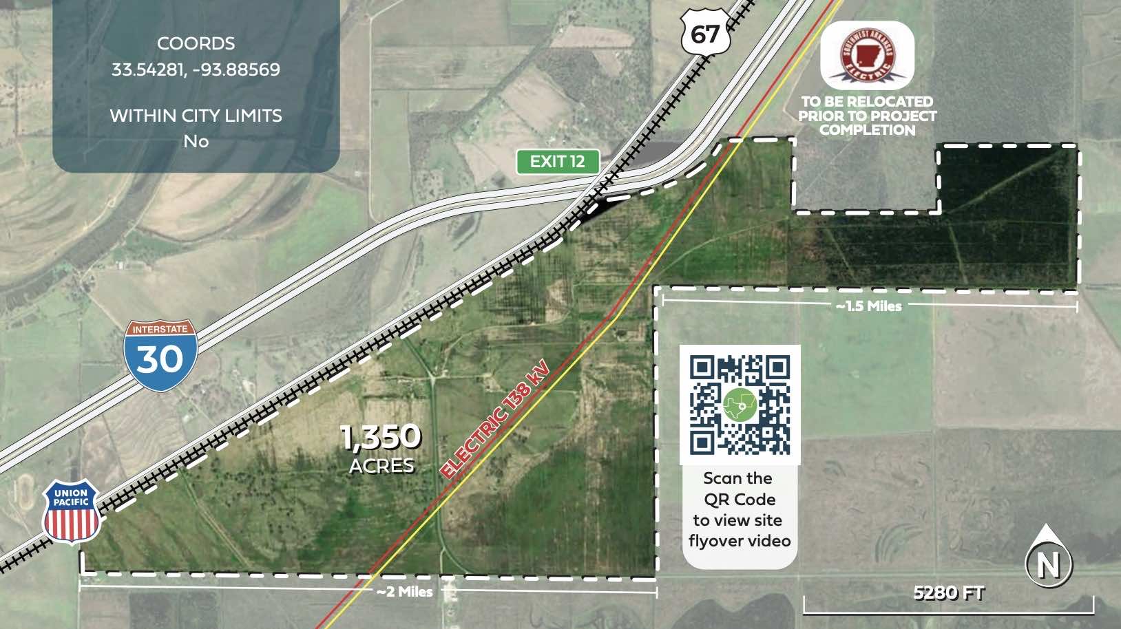
REDI Arkansas Manufacturing Center - 1,350.0 Acres
The REDI Arkansas Manufacturing Center is presented by AR-TX REDI, Texarkana’s regional economic development organization. A region with strong manufacturing roots, Texarkana was developed around a complex rail system more than a century ago and now has grown into a national crossroads for transportation that give this manufacturing complex an unrivalled competitive advantage. Under the control of AR-TX REDI, this United States manufacturing complex offers incredible opportunities for original equipment manufacturers (OEMs) who need to reach consumers or their customers on time and on schedule. Fronting Interstate 30 and U.S. Highway 67, the 1,350 acre site provides close connectivity to I-49 and future I-69 (currently I-369) as well as access to three U.S. highways including U.S 59, U.S. 71 and U.S. 82 within the region. The REDI Arkansas Manufacturing Center is within 300 miles of eight major cities including Dallas, Fort Worth, Houston, Oklahoma City, Little Rock, Memphis, Shreveport and Baton Rouge and a day’s drive to other markets such as San Antonio, New Orleans, Birmingham, Nashville, St. Louis, Kansas City and Mexico. And that means that you can reach 34 million people within 300 miles and more than 62 million within 500 miles of this site. A site could be free for a qualifying project.
Location
I-30
Texarkana, AR 71854
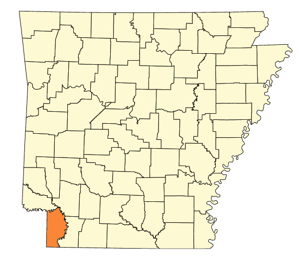
Miller County
33.53998, -93.87681
Listing Size
Available Acreage: 1,350.0 Acres
Max Divisible: 1.350.0 Acres
Min Divisible Available: 400
Subdividable
Property Type
Industrial
Airports
Texarkana Regional - 9.0 Miles
Shreveport Regional - 75.4 Miles
Hope Municipal - 15.8 Miles
Highway & Interstates
I-30 - 0 Miles
I-49 - 8.5 Miles
US 67 - 0 Miles
US 82 - 8.0 Miles
AR-108 - 2.65 Miles
Rail
Union Pacific - 0 Miles
Kiamichi - 6.7 Miles
Kelowna Pacific - 6.3 Miles
Waterways
Red River (Shallow) - 1.5 Miles
Cypress Bayou (Shallow) - 56.0 Miles
Port of Camden - 60.7 Miles
Port of Shreveport-Bossier - 83.0 Miles
Port of Little Rock - 121.0 Miles
Port of Fort Smith - 134.0 Miles
2025 Key Demographic Indicators (Esri)
| Indicator | Drive-Time: 30 Minutes | Drive-Time: 60 Minutes | Drive-Time: 90 Minutes |
|---|---|---|---|
| 2025 Total Population | 120,408 | 234,508 | 815,501 |
| 2025 Daytime Population (Esri) | |||
| Total Daytime Population | 127,010 | 229,976 | 814,992 |
| Daytime Population: Workers | 58,967 | 96,556 | 350,596 |
| Daytime Population: Residents | 68,043 | 133,420 | 464,396 |
| 2025 Income (Esri) | |||
| Average Household Income | $76,406 | $73,784 | $76,664 |
| Per Capita Income | $31,079 | $30,174 | $31,606 |
| 2025 Educational Attainment (Population Age 25+) | |||
| High School Diploma | 26,211 | 54,224 | 172,310 |
| Some College / No Degree | 17,809 | 34,288 | 118,219 |
| GED / Alternative Credential | 5,252 | 11,256 | 33,797 |
| Associate’s Degree | 7,556 | 14,529 | 52,505 |
| Bachelor’s Degree | 10,960 | 20,744 | 78,681 |
| Graduate / Professional Degree | 6,898 | 11,782 | 45,972 |
| 2025 Labor Force (Esri) | |||
| Employed Civilian Population Age 16+ (Base) | 50,731 | 97,217 | 342,047 |
| Occupation: Production | 4,079 | 8,421 | 25,317 |
| Occupation: Transportation / Material Moving | 4,643 | 9,854 | 32,056 |
| Occupation: Architecture / Engineering | 697 | 1,016 | 4,517 |
| Occupation: Farming / Fishing / Forestry | 343 | 928 | 1,808 |
| Occupation: Construction / Extraction | 2,320 | 5,079 | 19,558 |
| Occupation: Office / Administrative Support | 6,084 | 10,793 | 35,088 |
Site Videos (1 total)
Site Photos (16 total)
.png)
.png)

.png)

Utilities
- Electricity: AEP SWEPCO
- Water: Texarkana Water Utilities
- Telecommunications: Four States Fiber
- Natural Gas: Kinder morgan
- Sewer: Texarkana Water Utilities
- Fiber-Optic: Four States Fiber
Listing Price
- Lease Price: Not for lease
- Sale Price: $7,500 per acre
Additional Information
- Property ID: 1483
- Enterprise Zone: Yes
For More Information
AR-TX REDI
Rob Sitterley
2900 Saint Michael Drive 5th Floor
Texarkana, TX 75503
(903) 334-5201
(903) 824-1792
rob.sitterley@ar-txredi.com